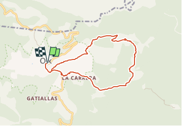
![](/images/other/stat-length.png)
![Tocht Te voet Montagut i Oix - Oix-Santa Bàrbara de Pruneres - Photo](https://media.geolcdn.com/t/1900/400/cb10d5bf-5a9a-4587-8bd4-b5f3a34880cd.jpeg&format=pjpeg&maxdim=2)
Oix-Santa Bàrbara de Pruneres
SityTrail - itinéraires balisés pédestres
Tous les sentiers balisés d’Europe GUIDE+
![Lengte](/images/other/stat-length.png)
![Max. hoogte](https://static1.geolcdn.com/siteimages/upload/files/1508320355ic_sort_altitude_max_24dp.png)
![Positief hoogteverschil](https://static1.geolcdn.com/siteimages/upload/files/1508320355ic_sort_den_pos_24dp.png)
![Km-Effort](/images/other/stat-length.png)
![Min. hoogte](https://static1.geolcdn.com/siteimages/upload/files/1508320355ic_sort_altitude_min_24dp.png)
![Negatief hoogteverschil](https://static1.geolcdn.com/siteimages/upload/files/1508320355ic_sort_den_neg_24dp.png)
![Boucle](https://static1.geolcdn.com/siteimages/upload/files/16400158638029165_repeat_loop_refresh_sync_direction_icon.png)
![Te voet](https://static1.geolcdn.com/sitytour/trail-icons/100.png)
3h01
Moeilijkheid : Gemakkelijk
![Scan deze QR-code om de tocht te openen in de SityTrail-applicatie](https://capi.geolives.com/qq0zvz2zws4bq2lad0pu/sitytour/trails/3110615/qr.png?size=200)
Gratisgps-wandelapplicatie
Over ons
Tocht Te voet van 8,2 km beschikbaar op Catalonië, Gerona, Montagut i Oix. Deze tocht wordt voorgesteld door SityTrail - itinéraires balisés pédestres.
Beschrijving
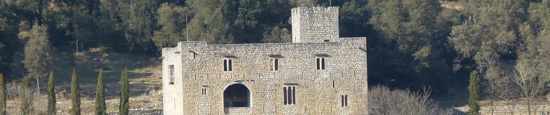
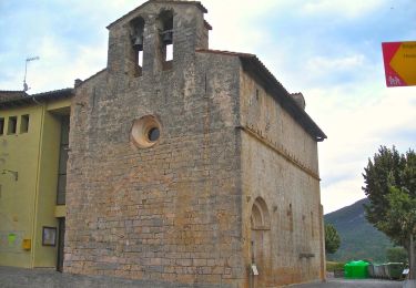
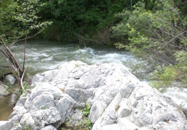
Breu introducció. Ruta circular pels voltants d´Oix, per arribar a l´església de Santa Bàrbara de Pruneres, que ens permet gaudir d´esplèndides vistes d´aquest entorn de l´Alta Garrotxa. Dades tècniques: Durada de la ruta. Unes 3 hores aproximadament, per a gent acostumada a caminar, sense comptar parades. Quilometratge. Aproximadament uns 8,95 quilòmetres. Desnivell de la ruta(…
Website: https://senderismegirona.org/2018/09/05/ruta-57-oix-a-santa-barbara-de-pruneres/
Plaatsbepaling
Opmerkingen
Wandeltochten in de omgeving
![Tocht Te voet Montagut i Oix - Oix-Grau d'Escales - Photo](https://media.geolcdn.com/t/375/260/f9abda2e-d7b1-4f67-a847-73dc649ba8e2.jpeg&format=jpg&maxdim=2)
![Te voet Te voet](https://static1.geolcdn.com/sitytour/trail-icons/100.png)
Te voet
![](/images/other/stat-length.png)
![](https://static1.geolcdn.com/siteimages/upload/files/16400158638029165_repeat_loop_refresh_sync_direction_icon.png)
![Tocht Te voet Montagut i Oix - 186 - Photo](https://media.geolcdn.com/t/375/260/2fb22bb4-f048-4ae0-954f-9845c4c16433.jpeg&format=jpg&maxdim=2)
![Te voet Te voet](https://static1.geolcdn.com/sitytour/trail-icons/100.png)
Te voet
![](/images/other/stat-length.png)
![](https://static1.geolcdn.com/siteimages/upload/files/16400158638029165_repeat_loop_refresh_sync_direction_icon.png)
![Tocht Stappen Montagut i Oix - talaixa - Photo](https://media.geolcdn.com/t/375/260/ext.jpg?maxdim=2&url=https%3A%2F%2Fstatic1.geolcdn.com%2Fsiteimages%2Fupload%2Ffiles%2F1553511878bg_sport_marche.png)
![Stappen Stappen](https://static1.geolcdn.com/sitytour/trail-icons/101.png)
Stappen
![](/images/other/stat-length.png)
![](https://static1.geolcdn.com/siteimages/upload/files/16400158638029165_repeat_loop_refresh_sync_direction_icon.png)